Friday 6th September 2013
From the Lions Den it's only about 33kms to Cooktown, and most of
this was downhill. On the way I saw Black Mountain, whose surface is
covered by a mass of large boulders caused by fissures in the granite
causing numerous fractures; the black colour is from lichen on the
surface. It's a protected area as it's home to several unique animal
species:
I rreached Cooktown around 1130. There's quite a lot to see there,
including a large monument to Captain Cook, commemorating his landing
there in June 1770:
There are a number of impressive heritage buildings along the wide
main street:
This memorial commemorates Mary Watson, an early settler who died
of thirst on nearby Lizard Island having fled from an attack by
hostile aborigines:
Waterfront view
A steep ride up Grassy Hill to the lighthouse gave some great
views over the town and the mouth of the Endeavour River:
Distance today 52kms, total 291kms.
Friday, September 6, 2013
Bloomfield Track
Thursday 5th September 2013
There's only one route north from Cape Tribulation, and that's along the Bloomfield Track, a 4WD only route through the rainforest that was only quite recently cleared, and it was created despite vigorous protests from environmental groups, who opposed any further disruption to the delicate ecosystem.
Start of Bloomfield Track
It's renowned as being a very challenging route to drive, owing to several very steep sections, and also river crossings which can become impassable very suddenly following the heavy rains which so often occur here. So I was expecting it to be tough going, and this certainly proved to be the case. The ascents are incredibly steep, indeed the climb seemed almost vertical at times. Fortunately it remained dry throughout most of the day, otherwise the descents would have been lethal.
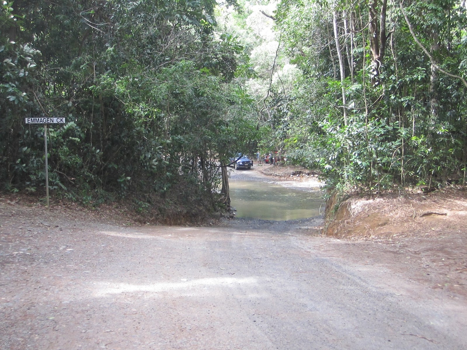
Emmagen Creek was the first water crossing I reached, and it wasn't too deep, I managed to cycle through it without getting the luggage panniers wet:
There wasn't much traffic on the route, a few holidaymakers in 4WDs and the occasional tour bus:
Woobadda Creek was knee deep and I had to take all the luggage off the bike and carry it across one piece at a time. I really didn't want to risk getting my computer, camera, Kindle, phone etc wet.
After about 30kms I reached Wujal Wujal, an aboriginal community. On the way into the village there were great views across the Bloomfield River:
After lunch there I went to take a look at the nearby Bloomfield falls which were quite impressive:
After this there wasn't much of interest, just a lot of climbing and descending along a very rough dirt road. Progress was slow, and by the time I reached the next camping spot, at the Lions Den Hotel, evening was fast approaching and I was glad of a place to stay the night.
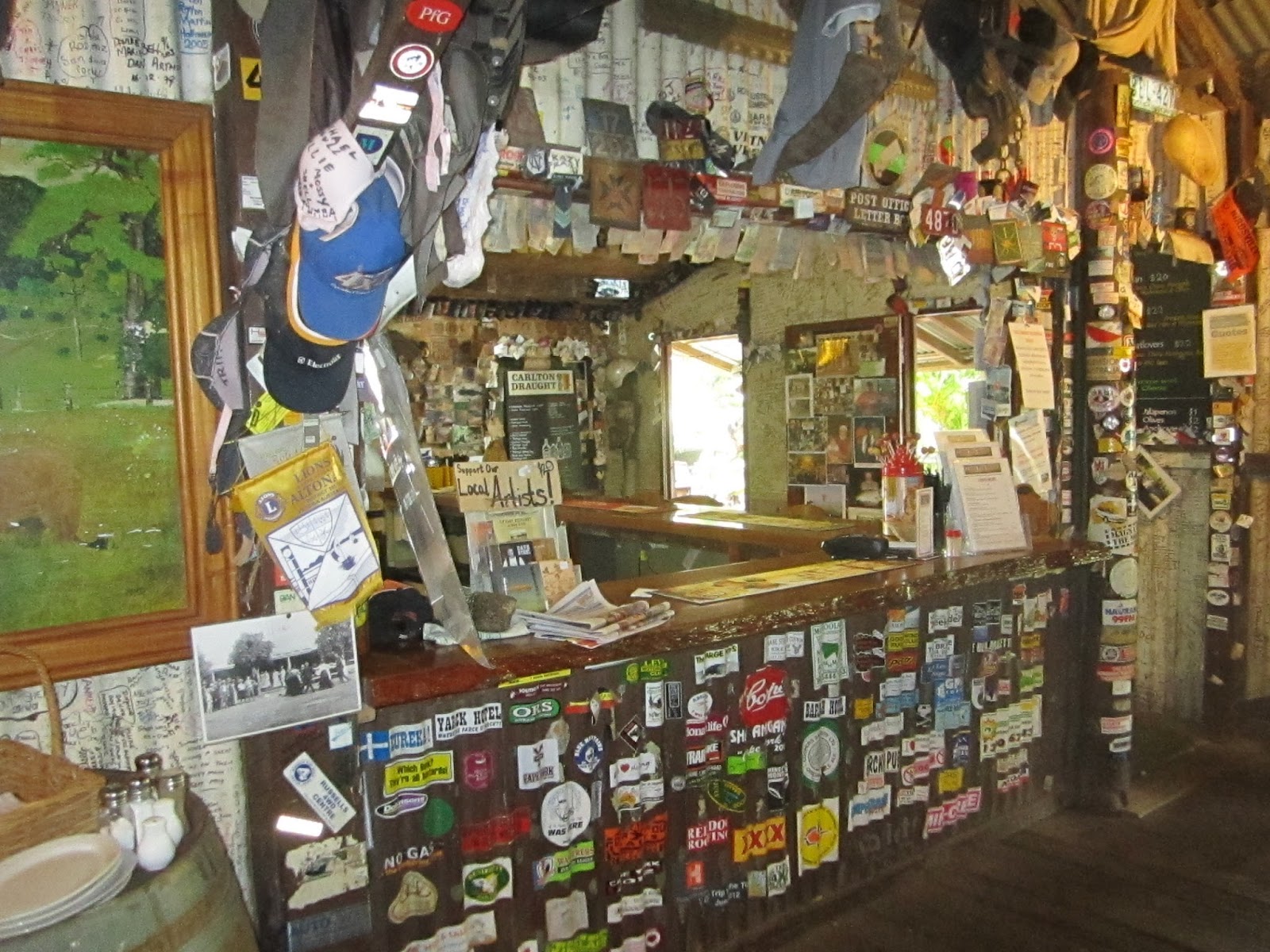
The Lions Den is a famous historic pub, founded in 1875 to cater for the nearby mining community. The mines closed long ago but it's still a busy place, the décor is typical of that found in many outback pubs:
Distance today 78kms, total so far 239kms.
There's only one route north from Cape Tribulation, and that's along the Bloomfield Track, a 4WD only route through the rainforest that was only quite recently cleared, and it was created despite vigorous protests from environmental groups, who opposed any further disruption to the delicate ecosystem.
Start of Bloomfield Track
It's renowned as being a very challenging route to drive, owing to several very steep sections, and also river crossings which can become impassable very suddenly following the heavy rains which so often occur here. So I was expecting it to be tough going, and this certainly proved to be the case. The ascents are incredibly steep, indeed the climb seemed almost vertical at times. Fortunately it remained dry throughout most of the day, otherwise the descents would have been lethal.
Emmagen Creek was the first water crossing I reached, and it wasn't too deep, I managed to cycle through it without getting the luggage panniers wet:
There wasn't much traffic on the route, a few holidaymakers in 4WDs and the occasional tour bus:
Woobadda Creek was knee deep and I had to take all the luggage off the bike and carry it across one piece at a time. I really didn't want to risk getting my computer, camera, Kindle, phone etc wet.
After about 30kms I reached Wujal Wujal, an aboriginal community. On the way into the village there were great views across the Bloomfield River:
After lunch there I went to take a look at the nearby Bloomfield falls which were quite impressive:
After this there wasn't much of interest, just a lot of climbing and descending along a very rough dirt road. Progress was slow, and by the time I reached the next camping spot, at the Lions Den Hotel, evening was fast approaching and I was glad of a place to stay the night.
The Lions Den is a famous historic pub, founded in 1875 to cater for the nearby mining community. The mines closed long ago but it's still a busy place, the décor is typical of that found in many outback pubs:
Distance today 78kms, total so far 239kms.
Wednesday, September 4, 2013
Mossman to Cape Tribulation
Wednesday 4th September 2013
The sky remained very overcast and there were occasional showers, not heavy enough for a soaking, but nevertheless sufficient to discourage me from making many photo stops. After about 30kms I arrived at the Daintree river, which is crossed by means of a cable-driven ferry, fare just $1 each way for bicycles and their riders:
North of the Daintree, the route soon begins a long, steep ascent through dense rainforest, up to the summit of Mt Alexandra.
From the summit there's a great view towards the mouth of the Daintree River. Pity it wasn't bright enough to get a decent picture:
Soon after enjoying the exhilarating descent, I stopped at the Daintree Ice Cream Company and enjoyed some exotic flavours including black sapote. Then a few kms on, this fish and chip shop at Thornton Beach was too tempting to resist:
I arrived in Cape Tribulation around 3.30pm and set up my tent in the campground at PK's Jungle Village, an agreeable place with a reputation as a party venue. It has very good facilities including an excellent bar area and swimming pool. However it was very quiet. No doubt the poor weather over the last few days has put people off coming, and the atmosphere throughout the whole place was fairly subdued.
I did manage to get in a decent walk along the beach and around Cape Tribulation, before the rain turned heavy again, continuing well into the night.
Distance today 68kms, total so far 161kms,
Cairns to Mossman
Tuesday September 3rd 2013
After about 15kms the road narrows and hugs the coast, becoming quite undulating. It's a very scenic route, somewhat reminiscent of the Great Ocean Road which I rode in March this year:
After about 70kms, early in the afternoon I arrived at Port Douglas, an old gold-rush port that has undergone a lot of recent development and is packed with designer boutiques and fancy restaurants.
It was too early to finish riding for the day, so I headed on to the next town, Mossman, which has a large sugar mill, but not much else.
Mossman - nothing to see here
Cairns to Cape York - ready to go...
Monday 2nd Sep 2013
About to set off from Sydney
Wednesday, April 3, 2013
Gisborne to Melbourne
Tuesday 2nd April 2013
The forecast was for showers, and the sky certainly looked threatening, so I tried to keep up a good speed to get to Melbourne before the rain started. For the first 10kms I couldn't avoid using the busy freeway, but then managed to find a quieter alternative route. From here the Melbourne skyline was clearly visible in the distance:
Passing by the airport, and through the north-western suburbs, I reached the city centre just after midday. Then the rain started. So I had managed to arrive without getting wet, always a big relief.
Distance today was 60kms, giving a total of 1940kms since leaving Adelaide over 3 weeks ago. During the journey I had only 1 puncture, no mechanical problems with the bike, and no near misses with, or aggression from, any motor vehicles.
Because it was so gloomy in Melbourne (it always is when I visit there) I didn't take many photos and am not planning to stay long, just 2 days during which I will catch up with friends. Then it's back to Sydney, to prepare for the next adventure!
The forecast was for showers, and the sky certainly looked threatening, so I tried to keep up a good speed to get to Melbourne before the rain started. For the first 10kms I couldn't avoid using the busy freeway, but then managed to find a quieter alternative route. From here the Melbourne skyline was clearly visible in the distance:
Passing by the airport, and through the north-western suburbs, I reached the city centre just after midday. Then the rain started. So I had managed to arrive without getting wet, always a big relief.
Distance today was 60kms, giving a total of 1940kms since leaving Adelaide over 3 weeks ago. During the journey I had only 1 puncture, no mechanical problems with the bike, and no near misses with, or aggression from, any motor vehicles.
Because it was so gloomy in Melbourne (it always is when I visit there) I didn't take many photos and am not planning to stay long, just 2 days during which I will catch up with friends. Then it's back to Sydney, to prepare for the next adventure!
Federation Square
Swanston St, Burke and Wills memorial
GPO and Bourke St Mall
Monday, April 1, 2013
Castlemaine to Gisborne
Monday 1st April 2013
I set off from Castlemaine around 1000, not very early but I was only intending to go to Woodend, around 60kms away, to see Hanging Rock, the setting of the well-known book and film.
After about 10kms, outside the small village of Chewton, there was an interesting monument to another large uprising against the mining tax back in the 1850s gold rush days:
The area is so quiet now, it's strange to imagine a crowd of 14000 people gathering here.
A few kms further on, I met up with 2 other cyclists who were also heading to Hanging Rock, They were on racing bikes and averaging 30kph but I managed to keep up with them and so arrived at the rock around 1230.
It's a volcanic outcrop, rising just over 100m above the surrounding plain. High soda content in the lava, which has been eroded by the action of rainwater, has created many unusual rock formations. It's been a very popular tourist spot for many years and of course notorious for the unexplained disappearance of a group of schoolgirls back in 1901, which became the subject of "Picnic at Hanging Rock"
It was very busy today, being Easter. The climb to the top doesn't take long but does involve a bit of clambering over slippery rocks:
This is the actual "hanging rock" which gives its name to the whole mountain:
There were great views to be had from the summit:
Here's a view of the rock from the approach road:
I'd intended to stay in nearby Woodend but there was no accommodation to be had there, so I rode on towards Melbourne, taking a scenic detour over Mt Macedon, on the advice of someone in the tourist office. It turned out to be a 12km hard uphill slog to the summit, which took over an hour, but well worth it to see the huge Remembrance Cross there, a memorial to those killed during WW1.
I set off from Castlemaine around 1000, not very early but I was only intending to go to Woodend, around 60kms away, to see Hanging Rock, the setting of the well-known book and film.
After about 10kms, outside the small village of Chewton, there was an interesting monument to another large uprising against the mining tax back in the 1850s gold rush days:
The area is so quiet now, it's strange to imagine a crowd of 14000 people gathering here.
A few kms further on, I met up with 2 other cyclists who were also heading to Hanging Rock, They were on racing bikes and averaging 30kph but I managed to keep up with them and so arrived at the rock around 1230.
It's a volcanic outcrop, rising just over 100m above the surrounding plain. High soda content in the lava, which has been eroded by the action of rainwater, has created many unusual rock formations. It's been a very popular tourist spot for many years and of course notorious for the unexplained disappearance of a group of schoolgirls back in 1901, which became the subject of "Picnic at Hanging Rock"
It was very busy today, being Easter. The climb to the top doesn't take long but does involve a bit of clambering over slippery rocks:
This is the actual "hanging rock" which gives its name to the whole mountain:
There were great views to be had from the summit:
Here's a view of the rock from the approach road:
I'd intended to stay in nearby Woodend but there was no accommodation to be had there, so I rode on towards Melbourne, taking a scenic detour over Mt Macedon, on the advice of someone in the tourist office. It turned out to be a 12km hard uphill slog to the summit, which took over an hour, but well worth it to see the huge Remembrance Cross there, a memorial to those killed during WW1.
This is nearly 1000m above sea level, and from here Melbourne and Port Philip Bay were clearly visible despite being 60kms away:
Close by is another lookout point, named after Major Mitchell, the first European to climb Mt Macedon:
About 4 kms back from the Memorial Cross is the access to the Camel's Hump, actually the highest point on the mountain, reached by a 10 minute steep climb. From here there are views to the east, including Mt Tarrengower which I climbed a few days ago:
Needless to say, the descent from there was long, fast, and very enjoyable, reaching 65kph. I arrived in Gisborne around 1800 and found accommodation in a decent motel there.
Distance today 109 fairly hilly kms, total so far 1880kms.
Subscribe to:
Posts (Atom)