Tuesday, March 25, 2014

Tasmania's East Coast

The Lonely Planet Cycling Australia Guide, the source of most of the rides in this blog, claims that Tasmania is Australia's best region for cycle touring, owing to its stunning scenery, good quality and lightly-trafficked roads, and the relatively short distances between towns. However it's also one of the rainier areas of Australia, and having a support vehicle, not only to carry the luggage, but also to ride in if persistent bad weather intervenes, is a big asset.

For this trip, which was undertaken with my very good friends Rob and Carole, who also accompanied me on the Sydney to Canberra ride  in December 2012, we were very fortunate to have another good friend, Mavis, travelling with us as driver of our support vehicle. The car was equipped with a rack which can take all 3 bikes.

We all met up at Port Melbourne on the afternoon of Wednesday 12th March 2013, to catch the 7.30pm sailing of the Spirit of Tasmania ferry. I had travelled from Adelaide the previous day; the others had driven from Sydney.


The crossing was uneventful and we arrived in Devonport, on Tasmania's north coast, at 7am the following morning. We had breakfast at a nearby cafe then went to meet Carole and Rob's friend, Phil who lives here, and with whom we were staying that night. He kindly drove us to Cradle Mountain where we spent the afternoon walking round scenic Dove and Wombat Lakes, past Marion Lookout and as far as Kitchen Hut:


The following day we set off from Devonport by car for Hobart, stopping for lunch on the way at Ross, where we visited the Female Factory, a women's prison in the convict era:


There was also a notable old bridge there, one of the oldest in Australia:


Arriving in Hobart in the afternoon we went to the recently opened Museum of Old and New Art (MONA), which was very impressive. We had about 2 hours there before it closed but could have stayed much longer.


Saturday 15th March 2013 – Mt Wellington

The first day of cycling. The 1270m mountain right outside Hobart was a good challenging ride to start with. The others opted for shopping at Salamanca Market, but kindly gave me and my bike a lift to the start of the C616 summit road, about 10km from Hobart city centre and at an altitude of 430m. I then began the relentless 11km climb, which averages a 7.6% gradient, arriving at the summit in about 1hr 15mins. Even though the weather was somewhat overcast there were still amazing views of the Derwent Estuary from the top:


The summit of Mt Wellington is renowned for being very windy and cold; it often snows there. I didn't want to remain up there for long, so began the lengthy and hugely enjoyable descent back to Hobart, stopping en route for a tasting plate of 6 beers at the Cascade Brewery:


I met up with the others at Salamanca Place in the centre of Hobart, and shortly afterwards we set off for Eaglehawk Neck, where we were to start the cycling tour back up the east coast, and where Phil's uncle owns a beach house where we were to stay the next 2 nights:


I rode an easy 20 km down to Port Arthur, and was joined by Mavis who'd come in the car, we visited the convict site there which is a well-known tourist attraction. There's plenty to see there, besides the old convict buildings there's a new museum which tells the history of the penal settlement, and also the memorial to the 35 people killed in the massacre there in 1996.


Monday 17th March – Eaglehawk Neck to Orford

Carole, Rob and I set off from Eaglehawk Neck at 9am, heading north along the Arthur Highway.


Eaglehawk Neck is a narrow isthmus separating the Tasman and Forestier peninsulas, which was once guarded by a row of guard dogs to prevent convicts escaping. The narrowest point is marked by this memorial:
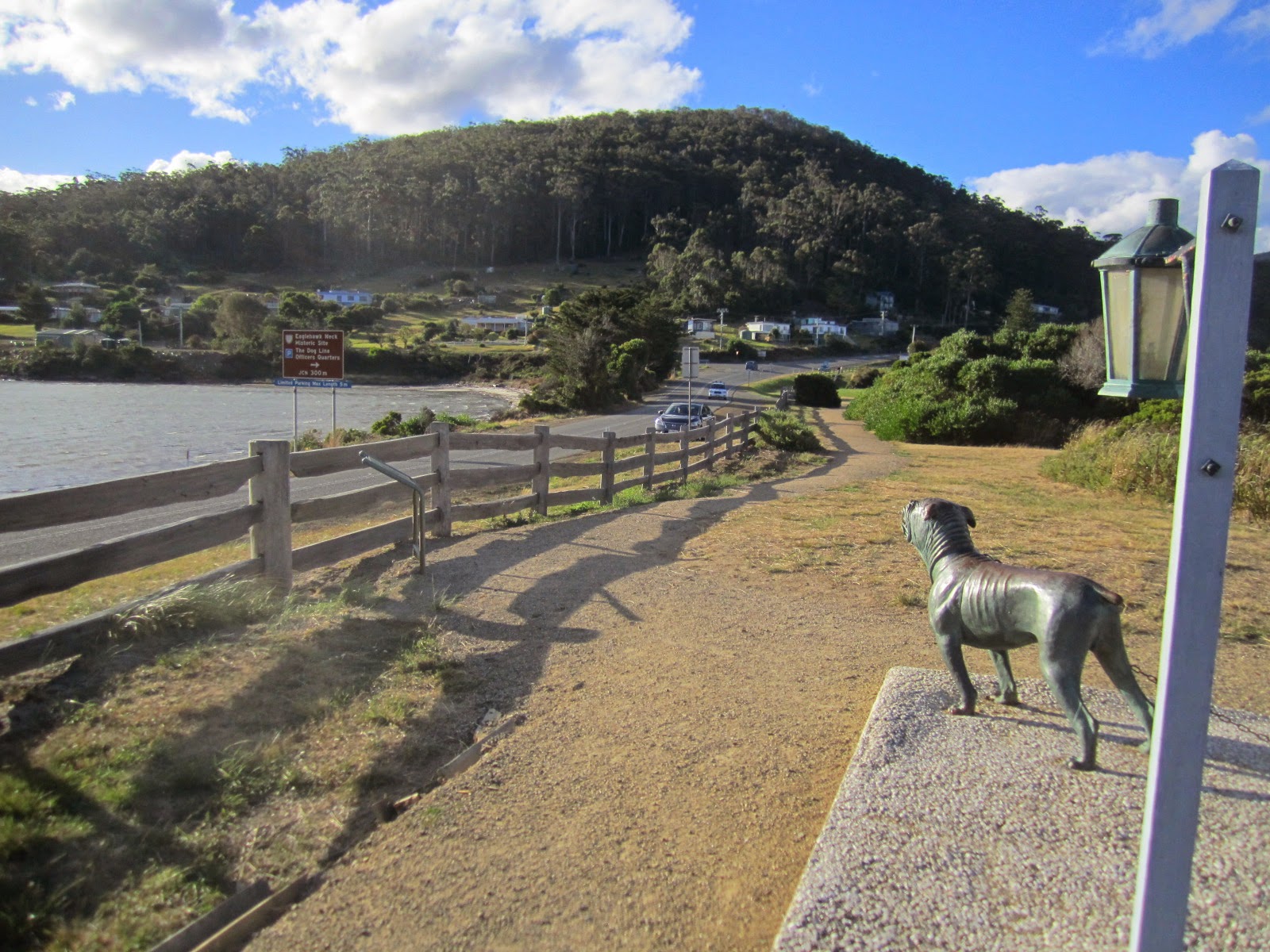


Looking back towards Eaglehawk Neck


Nearby is the Tessellated Pavement, a rock terrace resembling tiled paving, which was only partly visible due to the high tide:


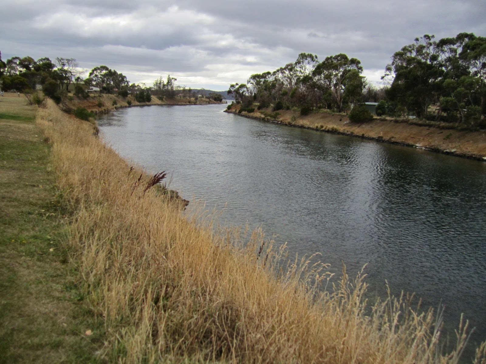
After 20 km we reached Dunalley and paused briefly to see Australia's only sea canal, the Denison Canal, a short cut between the east coast and the Derwent Estuary:


Also nearby is the monument to Abel Tasman, the first European to visit Tasmania, in 1642:


Soon after Dunalley the route followed a 40 km stretch of hilly, but very scenic, dirt road, much of it led through a forest of blue and swamp gums:


We rendezvoused with Mavis for lunch at the Sandspit Forest Reserve:
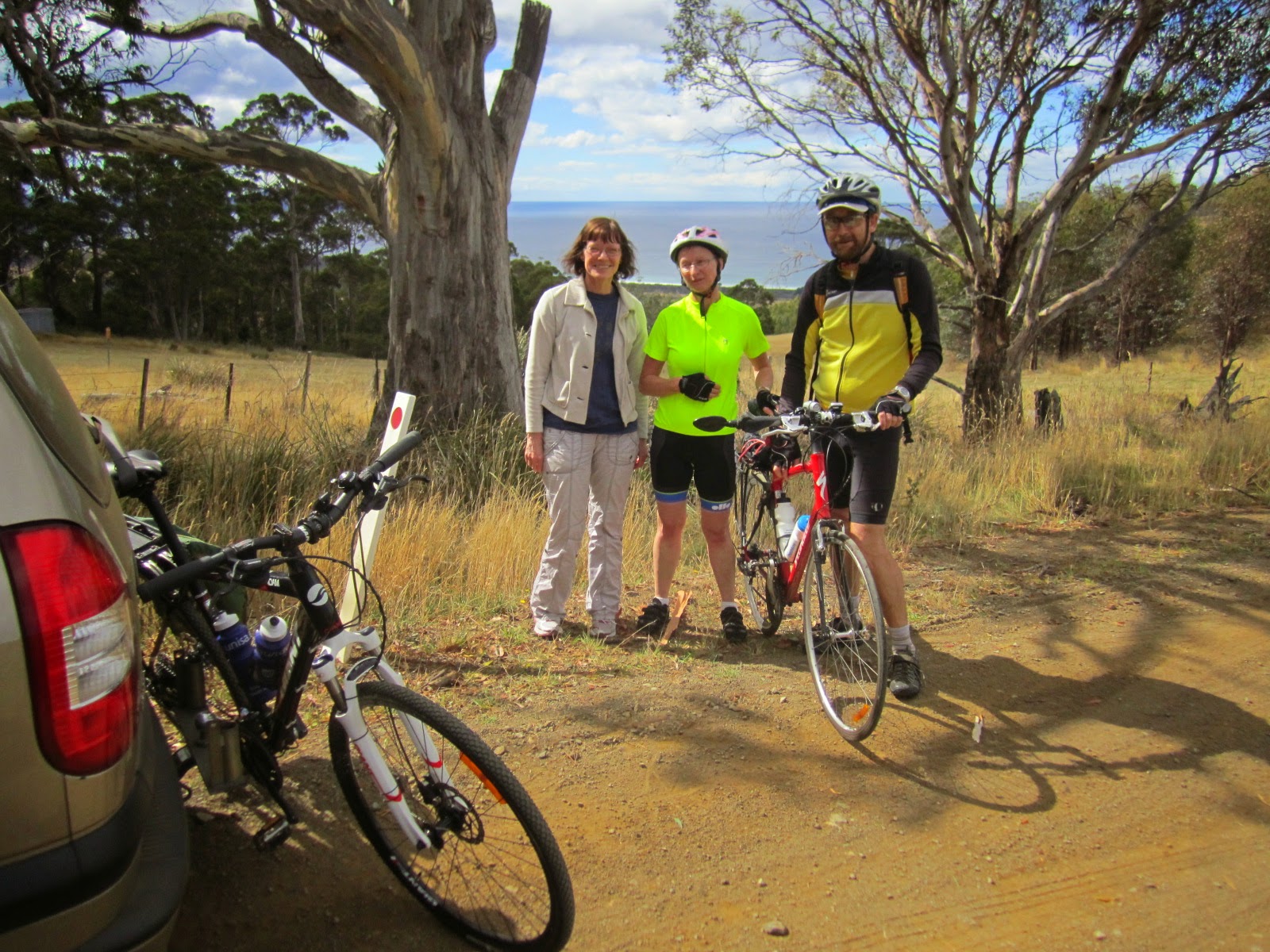


There was supposed to be a rainforest loop walk here but we were unable to find it, so continued with the ride; there was no relief from the climbing:


After about 70 km the route hit the coast again at Spring Beach, where Maria Island, tomorrow's destination, became clearly visible:

 
We arrived at Orford at around 4pm and checked into the Blue Waters Motor Hotel which was comfortable enough. Orford is a small, low-key resort but it did have a good restaurant, Scorchers, where we had an enjoyable dinner.

Distance ridden today 81 km.

Tuesday 18th March – Maria Island

Today we made the 30 minute ferry trip over to Maria Island, a former penal settlement, now a national park, where we put in a full day's hard walking, climbing the summit to Mt Bishop and Clerk, and also doing walks around the Painted Rocks and the Fossil Cliffs.
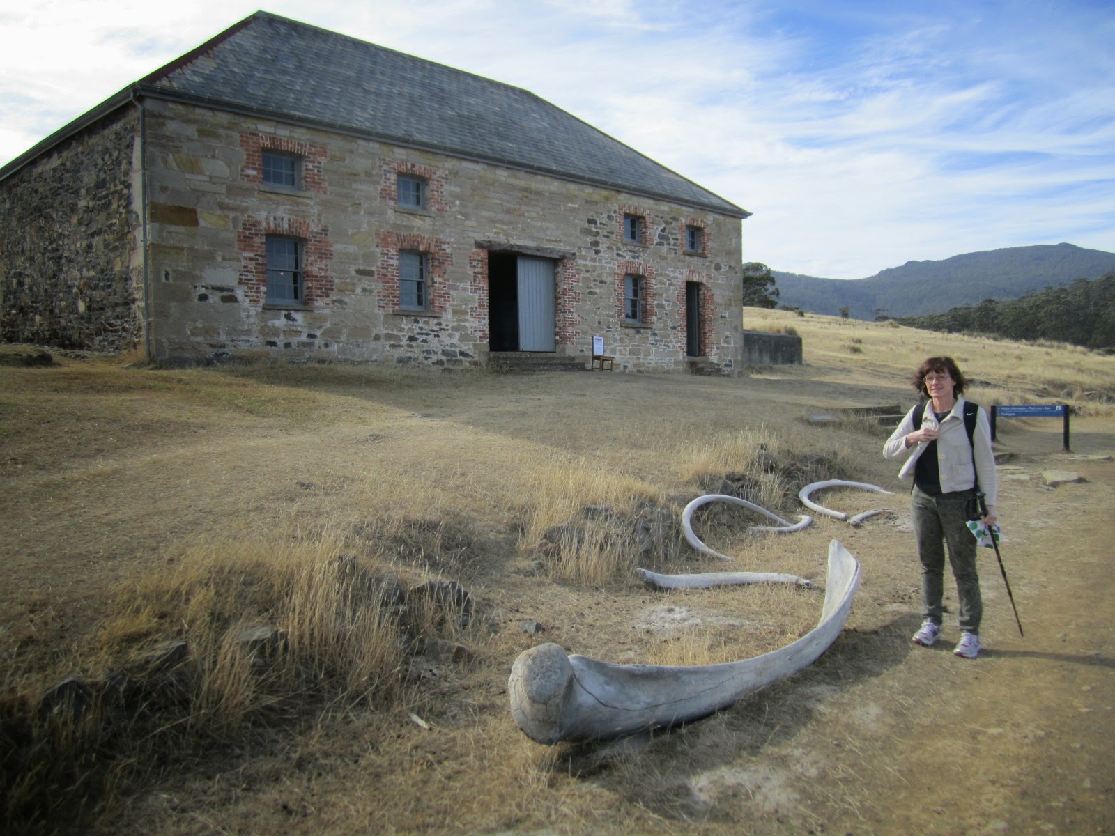


The Commissariat's Store


Fossil Cliffs


Bishop and Clerk summit


Many wombats can be seen on the island


Painted Cliffs
The walk up to the summit of Mt Bishop and Clerk was certainly tough, involving a lot of steep climbing over loose scree rock followed by some clambering over big boulders near the top. The effort is well worth while though because the views from the top are spectacular.

Wednesday 19th March – Orford to Coles Bay

Back in the saddle again for the next stage of the ride; today's destination being Coles Bay. Following the Tasman Highway along the coast, there were no hills to contend with and the riding was easy, with sea views along much of the way:


  At 51 km we reached the old convict-built Spiky Bridge which was a good place for a photo:

 
Soon afterwards we stopped for lunch at Swansea, where I took the opportunity to check the onward route options in the Visitor Centre. The route detailed in the Lonely Planet guide leaves the Tasman Highway shortly after Swansea and follows minor roads along a coastal spit to Point Bagot, from where, at the time the guide was written, a ferry service was available over to Swanwick, a few kms from Coles Bay. I'd been told that this ferry had ceased operating a few years ago, however I thought it was worth checking to see if there was any likelihood that if I rode to Point Bagot, there'd be boats in the vicinity which might take me and my bike across the narrow 200m estuary.

The advice from the visitor centre was that there was still no organised ferry service, but that there was a possibility that there might be a boat there willing to take me and my bike across, which would save around 45kms distance compared to the inland route. I decided to ride along the spit, following the Lonely Planet route, however when I reached Point Bagot there were no boats to be seen, and the estuary was certainly too wide to swim across:


So I had to retrace the last 16 km of the route, then continued north along the Tasman Highway, passing the Moulting Lagoon:


Turning east along Coles Bay Rd back towards the coast, it was getting towards sunset by the time I reached Coles Bay, gateway to the Freycinet Peninsula. I detoured briefly off the route to Swanwick, across the estuary from Point Bagot where I'd been several hours earlier:


After a good dinner at the Iluka Tavern we set to work on a 1000 piece jigsaw showing the map of Australia, working on it until very late in the night.

Distance cycled today 154kms, total so far 235 km

Thursday 20th March Coles Bay to Bicheno

The jigsaw was finally completed at breakfast, just before it was time to pack up and leave:


With our knowledge of Australian geography vastly improved, we set off for the Freycinet National Park, where we did several walks, the first being up to the popular lookout over Wineglass Bay:


This rock at Sleepy Bay was surprisingly difficult to climb into:


After spending the morning walking, we had lunch at the bakery in Coles Bay then set off for the short 38km ride to Bicheno. Rob set the pace and we got there very quickly, in under an hour and a half.

We enjoyed a very good dinner at Passini's restaurant.

Distance cycled today 38 km, total so far 273 km

Friday 21st March – Bicheno to St Helens

Before leaving Bicheno we took a look at the Blowhole there:


The route continued north along the Tasman Highway, which was flat and fairly quiet. After about 30 km it diverged inland over the steep Elephant Pass, climbing to 400m over a distance of about 8 km. At the summit is the renowned Elephant Pancake Barn, however it was too early for lunch so the pancakes had to be resisted:


The whole pass is heavily forested so unfortunately there weren't any decent views to be had in reward for all the climbing effort.

A few kms further on lay St Mary's, a pleasant little town with an interesting museum housed in its former railway station:


Then there was a fast descent back towards the coast, through the sprawling village of Scamander:


It was cool and overcast but fortunately the rain held off, and there was a tailwind, so the destination, St Helens, was reached by 3.15pm. We considered riding a further 24 km side trip to Binalong Bay and back, but rain was threatening so we took the car there:


In the evening we had a really excellent meal at the Blue Shed restaurant in St Helens. Expensive, but worth it; by far the best food we had in Tasmania. Although the atmosphere is nothing special, and the service not particularly friendly.

Distance cycled today 84 km, total so far 357 km


Saturday 22nd March – St Helens to Scottsdale

From St Helens the route turned inland and quickly became hilly:


After 30 km we came to a big climb over Weldborough Pass, ascending to 600m over a distance of 8 km:


Descending to 400m we reached the tiny village of Weldborough, once home to a large tin mining community, where there was an excellent pub serving a good selection of local boutique beers; we enjoyed a good lunch there:


It rained a bit while we were having lunch, so we waited a while until it stopped. The wet road, combined with a long stretch of roadworks shortly afterwards, left us and our bikes rather muddy.

The next town, Derby, had some attractive old buildings dating from the tin mining era:


The highway rolled on to Scottsdale, the largest town in north east Tasmania, our destination for the day:


Here we found accommodation at a bed and breakfast and set about cleaning all the mud off the bikes. There was a bit of trouble with the proprietor when he found us using one of his dishwashing brushes on them!

On checking Rob's bike, the rear tyre had become dangerously worn and damaged, as this photo shows:


No bike shops until Launceston, so he will have to ride on and hope it holds out.

Distance cycled today 105 km, total so far 462 km


Sunday 23rd March – Scottsdale to Launceston

The first 10 km of today's ride was through agricultural countryside, passing a series of tree-trunk carvings:


We then reached the tough 6 km climb through native forest over the Sideling Pass to a height of nearly 500m, from where there was a great view:


On a clear day Flinders Island, in the Bass Strait, can be seen from here.

From Sideling Pass it's downhill pretty much all the way to Launceston, and it wasn't long before the suburbs came into view:


On reaching Launceston we checked into the Old Bakery Inn, which had been recommended by Phil and which proved a comfortable place to stay:


After lunch we set off to explore Launceston. I spent an hour or so at the motor museum, which had a nice collection of old cars:


Next I went up to Cataract Gorge and walked the steep Zigzag trail:


Then I had a short ride around the city, seeing some interesting old buildings including Boag's Brewery:


We had a good evening meal at the Cock and Bull Hotel, close to where we were staying.

Distance cycled today 75kms, total so far 537kms


Monday 24th March – Launceston to Devonport

The Lonely Planet ride we've been following actually finishes in Launceston. However since we had to get to Devonport to catch the ferry home, it seemed sensible and worthwhile to ride there rather than taking the car.

Heading north from Launceston along the Tamar Valley highway, on reaching Legana the route branched off along the C732, a quiet road which eventually connected with the B71 running west from Exeter. Most of this road had a dirt surface:


There were no towns or facilities along the route, which passed through fertile pastureland:


I reached Devonport at 1.45pm, and after meeting with the others later, we loaded the bikes onto the car all ready for the evening voyage back to Melbourne:

Distance cycled today 110 km, trip total 647 km


It's been a great trip; we've been incredibly lucky with the weather,  the car has been very useful to transport all our luggage and we're all very grateful to Mavis for doing all the driving. I would certainly recommend Tasmania as an excellent place for cycle touring, and hope to return here for more riding soon.

Wednesday, January 8, 2014

Kosiuszko High Country

Another ride from the Lonely Planet Cycling Australia book, this route crosses the heart of Kosiuszko National Park on fire trails and off-road tracks, then follows the scenic Alpine Way.

Day 1 – Thursday 2nd January 2014

The first problem was getting to the start. Outside the ski season, which runs from June to October, the nearest place to the start of the route which can be accessed via public transport is Cooma, around 80kms away. Getting to Cooma took the best part of a day and involved 2 bus journeys, plus a ride from Sydney's north down to the Greyhound terminus at Central station. The Greyhound service took me to Canberra, where there was a 3 hour wait for the connecting NSW Countrylink service to Cooma. Both buses were quite full, with people returning home after the New Year holiday, but I had no difficulty getting my bike in the luggage hold, fortunately.

While in Canberra I took the opportunity to have a bit of a ride around the city, and Parliament House is always a nice place to visit:


Arriving in Cooma around 6pm I found the local campsite and having set up my tent, headed into town for a tasty fish dinner at the Alpine Hotel.

Distance cycled today 40kms


                                                                      Cooma

Day 2 – Friday 3rd February 2014

I set off around 9am and reached headed south along the Kosciuszko Highway towards Jindabyne. Just outside Cooma there is a memorial to the passengers in the Southern Cloud, a plane which crashed nearby in 1931, with fragments of the plane on display:


20kms further is this unusual metal sculpture by the roadside. There's no descriptive plaque explaining what it's meant to represent.


After another 40kms, across rolling countryside with an altitude varying between 800m and 1000m, Lake Jindabyne came into view:


I spent a couple of hours in Jindabyne, a place I'd visited back in 2010 during my Melbourne to Sydney  ride, having lunch, buying a detailed map of the Kosiuszko National Park, and getting supplies for the next few days, as there are no shops or restaurants between here and Thredbo, the final destination of the LP route.

Then I headed in a north westerly direction, climbing sharply for about 15kms, reaching an altitude of 1600m, another 650m higher than Jindabyne, at Rennix Gap:


From here it was about another 5kms downhill to the campsite at Island Bend, near the site of a former village built for construction workers during the building of the massive Snowy River hydroelectric project, and long since abandoned. It was nearing 8pm by the time I arrived and there was just time to pitch the tent and have dinner before it got dark. I was expecting it to be very cold at this altitude – around 1350m – but it turned out to be quite a mild night.


Distance today 100kms

Day 3 – Saturday 4th January 2014

There was about 8kms of tarmac road from Island Bend to Guthega Power Station, beside the Snowy River, where the route follows the Schlink Pass, a dirt track which quickly becomes very steep, climbing over 200m in little over 2kms.


The high point of the ride is here – at 1804m:


The route passes a number of emergency huts for use when people get stranded on the mountain – it can snow here any time of year. This very remote area is called the Jagungal Wilderness:


The route then followed the Geehi fire trail, with about 14km of fairly smooth, highly enjoyable downhill:


Then there were a few short, but intense climbs towards Olsen's Lookout, which gave excellent views of the western faces of the Kosiuszko Main Range:


It was then mostly downhill towards Geehi campsite, a popular camping area beside the Swampy Plain River:


It was a pleasant place to camp, the only bad aspect being the huge blood-sucking horseflies that were everywhere and which didn't seem to be repelled at all by Aerogard spray. I did manage to have a refreshing dip in the river and it wasn't too cold. The altitude here is about 400m.

Distance today 72kms

Day 4 – Sunday 5th January 2014

To quote from the LP guide, today's section of the ride “serves up a supreme fitness challenge”. Having ridden it, I cannot disagree with this.

The figures speak for themselves – the day starts at 400m, climbs to 800m, descends back to 600m then ascends to nearly 1600m. That's 1400m of ascent.

The whole section of route is along the Alpine Way, and the climbing starts immediately – 400m ascent in the first 9kms of riding, through a eucalypt forest. Then there's a long downhill towards cleared country surrounding the Murray River, which forms the border between NSW and Victoria. At 20kms, the Tom Groggin picnic area was a good place to rest before the next big ascent:


The next 5km of road climbs 450m vertically; then there's a 1km descent to Leatherbarrel Creek, where another rest stop was in order:


From here it was another 11kms to the top of the climb. There were great views to be had, particularly at the Pilot lookout:


The peak is reached at Dead Horse Gap (1580m):


….after which it was downhill all the way to Thredbo, arguably Australia's premier Alpine resort and one of the few that are open all the year round.


Distance today 46km – not far in terms of distance, but still a very tough day's cycling.


Day 5 – Monday 6th January 2014

It was time to take a break from cycling, so I spent the day walking to the top of Mt Kosiuszko, at 2228m Australia's highest peak. Most people take the Kosiuszko Express chairlift, which starts in Thredbo village at 1350m, up to the top station at 1930m, and walk from there, but I decided to walk the whole way.


The path up to the top of the chairlift is extremely steep and it took about an hour and a half to get up to the top station. I had a much-needed drink in the restaurant there (which is Australia's highest) then continued on to the summit along the very well marked walkway. It's another 13km return walk from here but very easy, and the scenery is of course magnificent:


There were traces of snow still remaining:


I reached the summit around 1pm and enjoyed a brief moment at the top of Australia:


Then it was back down the same way. On the left of this photo, going past Australia's highest toilet, is the path leading down to Perisher Valley:


After all that effort, I felt justified in riding the chairlift back down, enjoying the views overThredbo on the way:


Day 6 – Tuesday 7th January 2014

Time for more cycling! Thredbo is renowned as a mountain biking centre, with a number of downhill trails accessed from the top of the chairlift. I'd never done proper MTB before so had to do an induction course, then I was able to get my hands on a Giant Reign:


I managed to do the Kosiuszko Flow Trail 7 times during the day, every one was really scary but hugely exciting. By the end I managed to descend all the way without stopping or putting a foot down. There are some incredibly tight, rocky corners, lots of trees to avoid, several ramps, and other obstacles which make this a real adrenaline rush.


Despite a few tumbles I managed to survive the day intact! I would love to return here and do this trail again some day.

Day 7 – Wednesday 8th January 2014

It was time to ride back to Cooma, from where I would get the bus back to Canberra then on to Sydney.

It was a misty morning, unlike the clear weather of the past few days:


On the way out of Thredbo there's a good view of the area where the tragic landslip took place back in 1997 with the loss of 18 lives:


It was downhill pretty much all the way to Jindabyne, 33kms away. By the time I arrived there all the clouds had vanished and it was a beautiful sunny day. I sat by the statue of Count Strezlecki, and watched a water-skiing contest taking place on the lake:


After a short steep climb out of Jindabyne there was another great view of the lake:


Then it was back to Cooma along the route I'd ridden last week.

I arrived in Cooma at 5pm,  having ridden 95kms.

It's been a tough but very enjoyable week. I've been very lucky with the weather, there has been no rain and temperatures have been mild. Definitely a excellent trip!

Total trip distance 353kms.


Thursday, October 10, 2013

Airlie Beach and Proserpine

Monday 7th October 2013


After Townsville my next stop on the journey south was Airlie Beach where I'd originally intended to spend a couple of days relaxing on the beach and enjoying the party atmosphere.


                                                                                      Airlie Beach Lagoon

However when I found out that there was a 30km walking track nearby that was said to be good for mountain biking, it seemed worth investigating further.


The Whitsunday Great Walk traverses Conway State Forest and Conway National Park, and it doubles as a walking and mountain biking trail. From the start, up several flights of steps at the top of Airlie Beach, it ascends up a very steep track and I was pushing the bike most of the first 5 kms:


There was a good view over the town from the summit, with the Whitsunday Islands in the distance:


Then the next 15kms or so was a rollercoaster ride along a bumpy, rocky track, it was hard work but fantastic fun, especially as I've not had much previous experience of proper mountain biking.


There was another good view over the islands later:


...and a couple of fairly shallow creek crossings:


Then I suffered my first flat tyre  in ages. It turned out to be not a puncture, but a torn valve stem – probably caused by the roughness of the terrain. Obviously this couldn't be repaired so it was as well that I had a spare inner tube with me.


The last 10kms or so were fairly flat, but still good fun. I didn't see much in the way of wildlife, apart from this large goanna climbing up a tree:


The route ends at Brandy Creek and from there it was about another 15km into Proserpine, the nearest town. I decided it would be good to take a look there as I'd not been there before, but needn't have made the effort, there is nothing much to see in Proserpine. Just one or two reasonably good Art Deco buildings:


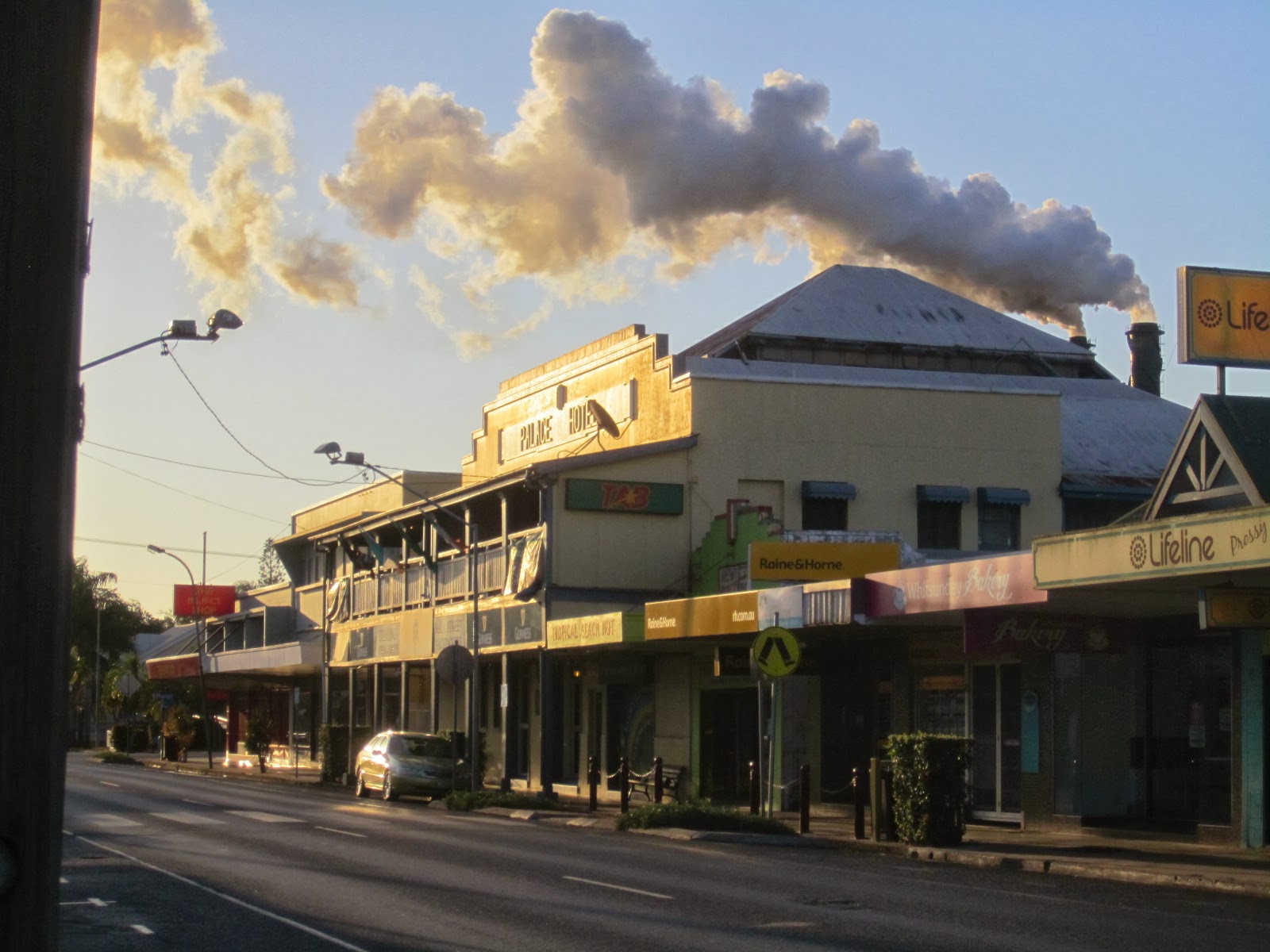
...And a sugar mill belching out foul-smelling fumes over the town:


Distance cycled today just 56kms – but they were tough ones. I caught the bus back to Airlie Beach from Proserpine, feeling lazy after all the climbing earlier on.