Monday
30th September 2013
I'd
been to the Visitor Centre when I arrived at Yungaburra yesterday to
find out about walking routes up Mt Bartle Frere, Queensland's
highest mountain, which I'd been told was quite close by. Normally
Visitor Centres here in Australia are very good and have all the
information anyone could want, but this one didn't have much about
walking trails. Eventually I managed to get the staff member to find
a map on the internet and print iit out for me, but it wasn't very
detailed. I was told that it normally takes about 8-10 hours to do
the return walk to the summit, so I thought that I should be able to
manage it in a day.
I
didn't manage to get a very early start, it was about 8am by the time
I set off to cycle to the start of the walking track. It looked from
the map that it was only about 15kms away so I thought I'd be there
by 9am. In fact it turned out to be nearly 30kms away and about half
that was along a dirt road, also I had to go up a lot of hills to get
there. Result was that I didn't get to the start of the walking track
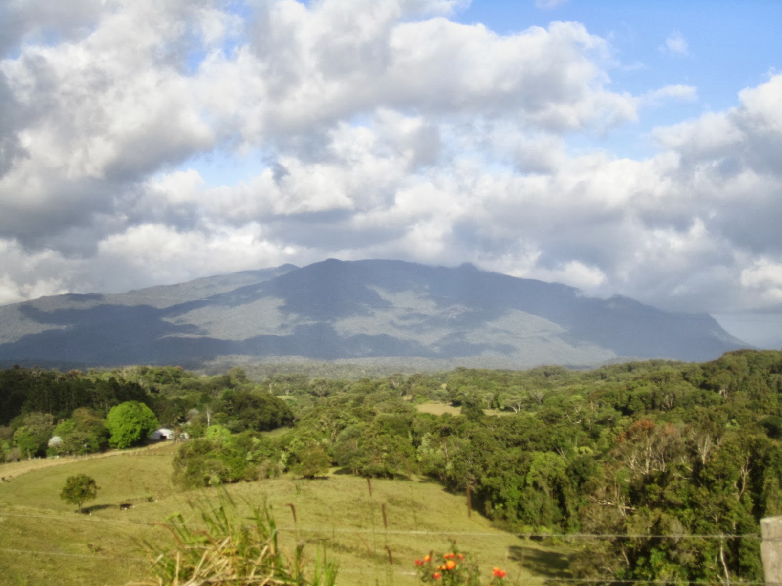
until 1030am. On the way I took a photo from the Lamins Hill lookout:

It
was somewhat overcast and it looked as though rain was coming. This
is one of the wettest areas in Australia and weather conditions here
can change very suddenly.
Anyway
I locked my bike up at the start of the walking track and set off on
the climb. There was nobody else around. After about 30 minutes I
came to Bobbin Bobbin Falls, which I could tell from the map was the
only source of water on the mountain, so I took the opportunity to
fill up my water bottle:

Bartle
Frere is entirely covered in dense rainforest, and the path to the
summit is very uneven and overgrown. It's quite well marked with
little orange reflective arrows on trees every 50m or so, but it's
still quite easy to lose your way there, and apparently many people
do.
In
places there are large boulders you have to climb over:

...and
there are tree stumps and other obstacles everywhere to trip over:

At
about 1pm, after 2 and a half hours hard climbing, I reached the
lower summit which is about 1470m above sea level. I decided to turn
back at this stage, because I could see that it was another 2km and
200m ascent to the main summit, which would take at least another
hour, and I knew that I had another 2 hour bike ride back to
Yungaburra when I got back down to the car park. I was already pretty
tired and didn't want to risk an injury from tripping or falling, as
there was no mobile phone signal there and nobody around to help if I
was unlucky enough to injure myself. It gets dark here around 6.30pm
and I didn't want to be out riding after dark.
It
took longer to come back down than it did to go up, I had to take it
easy to avoid slipping on the path. I was back at the car park around
4pm and set off on the ride back straight away, pausing soon
afterwards to take a final photo of the mountain that I had
unsuccessfully tried to climb:
I
was back at the hotel in Yungaburra around 6pm, pretty well
exhausted. It was disappointing not making it to the top of Bartle
Frere but at least I did have a good scenic walk through the
rainforest, and even saw a few snakes. Maybe I will return and
attempt the climb again one day, but would get there earlier and
would avoid having to do a long bike ride as well on the same day.
Distance
cycled today 60kms, trip total 313kms
Mt Bartle Frere is a majestic peak that offers an awe-inspiring. VPN Slow Down Your Internet? Its challenging trails, lush rainforest surroundings, and panoramic views at the summit make it a must-visit destination.
ReplyDelete